AAU Herbarium Database |
| New Search Modify Search |
| Collector | Maxwell, J.F. |
| Number | 86-668 |
| Collected with | |
| Country | Thailand |
| Subpart | Pattalung |
| County | |
| Locality | Tamote district. Tamote Falls National Park. Margins of the primary evergreen forest along the rocky (granite) river. |
| Coordinates | |
| Minimum elevation (m) | 200 |
| Maximum elevation (m) | 200 |
| Start date | 1986/09/10 |
| End date | 1986/09/10 |
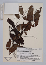
| Family | Rhamnaceae |
| Identification | Ventilago maingayi M.A.Lawson |
| Determined by | |
| Identification qualifier | |
| Field notes | Canopy liana, stem 9 cm diameter near the base; bark grey, with vertical grooves; fruiting calyx and nut brown, wing light brown; blades dark green above, green underneath. |
| |
| This record has no coordinates. Display map with the 2 georeferenced records of Ventilago maingayi in the AAU Herbarium Database. |
| New Search Modify Search |