AAU Herbarium Database |
| New Search Modify Search |
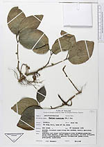
| Collector | Maxwell, J.F. |
| Number | 85-1168 |
| Collected with | |
| Country | Thailand |
| Subpart | Songkla |
| County | |
| Locality | District Haad Yai. Ko Kong Hill, base side of SE. side |
| Coordinates | |
| Minimum elevation (m) | 0 |
| Maximum elevation (m) | 0 |
| Start date | 1985/12/27 |
| End date | 1985/12/27 |
| Family | Aristolochiaceae |
| Identification | Thottea tomentosa (Bl.)Ding Hou |
| Determined by | |
| Identification qualifier | |
| Field notes | Shaded, alluvial area along the stream; mostly secondary forest. Pedicels and other inflorescence axes brownish-greenish; calyx dark maroon, lobes rarely yellowish; anthers orangish; fruits blackish-dark maroon; blades dark green above, grey-green unterneath |
| |
| This record has no coordinates. Display map with the 12 georeferenced records of Thottea tomentosa in the AAU Herbarium Database. |
| New Search Modify Search |