| Collector | Madsen, J. E. |
| Number | 63473 |
| Collected with | |
| Country | Ecuador |
| Subpart | GUAYAS |
| County | |
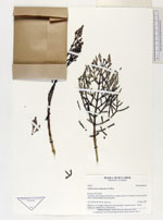
| Locality | Isla Puná. From midway Puná Nueva - Zapote and km 0-3 inland. Savanna and dry forest. Further beaches and salt marsh. |
| Coordinates | 2° 45' S 79° 54' W |
| Minimum elevation (m) | 0 |
| Maximum elevation (m) | 0 |
| Start date | 1987/05/29 |
| End date | 1987/05/29 |
| Family | Amaranthaceae |
| Identification | Mangleticornia ecuadorensis P.W.Ball, X.Cornejo & G.Kadereit� |
| Determined by | G.Kadereit |
| Identification qualifier | |
| Field notes | Shrub, to 1.5 m high. Common in the salt marsh. Common name: Vidrillo (source: E. Montero Ch., Puná Nueva). |
|
 Other records of Mangleticornia ecuadorensis