| Collector | Lawesson, J. E. |
| Number | 44495 |
| Collected with | Thomas Laessoe & Peter Moller Jorgensen |
| Country | Ecuador |
| Subpart | NAPO |
| County | |
| Locality | Río Lagarto Cocha. 2 hours upstream from Río Aguarico, near Redondo Cocha. Primary rain forest. Terra firme. |
| Coordinates | 0° 35' S 75° 15' W |
| Minimum elevation (m) | 190 |
| Maximum elevation (m) | 190 |
| Start date | 1983/06/17 |
| End date | 1983/06/17 |
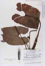
| Family | Araceae |
| Identification | Anthurium macdanielii Croat |
| Determined by | Croat, T.B. (MO), 1996. |
| Identification qualifier | |
| Field notes | Epiphyte. Spade green, deep brown purple. |
|
 Other records of Anthurium macdanielii