AAU Herbarium Database |
| New Search Modify Search |
| Collector | Solomon, J.C. |
| Number | 12429 |
| Collected with | |
| Country | Bolivia |
| Subpart | Beni |
| County | |
| Locality | Prov. Ballivian. Estacíon Biológica del Beni. Entering by Estancia El Porvenir (51 km E of the Río Maniqui), then 10 km N, crossing the Río Curiraba, then 1 to 2 hrs. by trail, crossing Arroyo Aguas Negras. |
| Coordinates | 14° 39' S 66° 20' W |
| Minimum elevation (m) | 250 |
| Maximum elevation (m) | 250 |
| Start date | 1984/09/30 |
| End date | 1984/09/30 |
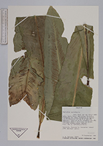
| Family | Aspleniaceae |
| Identification | Asplenium serratum L. |
| Determined by | H.v.d.Werff |
| Identification qualifier | |
| Field notes | Epiphyte. Seasonally inundated forest with abundant palms. |
| |
| Display all 84 georeferenced records of Asplenium Asplenium serratum |
| New Search Modify Search |