| Collector | Brandbyge, J. |
| Number | 772 |
| Collected with | |
| Country | Bolivia |
| Subpart | La Paz |
| County | |
| Locality | About 10 km from Quime on the road to Caxata. Degraded upper andean forest. Secondary vegetation on rocky slopes. |
| Coordinates | 17° 0' S 67° 12' W |
| Minimum elevation (m) | 3400 |
| Maximum elevation (m) | 3400 |
| Start date | 1987/04/25 |
| End date | 1987/04/25 |
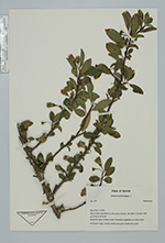
| Family | Solanaceae |
| Identification | Saracha punctata Ruiz & Pav. |
| Determined by | Andres Orejuela |
| Identification qualifier | |
| Field notes | Shrub 2,5 high. Corolla outside pale green inside dark purple. |
|
 Other records of Saracha punctata