| Collector | Brandbyge, J. |
| Number | 512 |
| Collected with | |
| Country | Peru |
| Subpart | Puno |
| County | |
| Locality | Huancasayani between Abra Aricoma and Limbani. |
| Coordinates | 14° 13' S 63° 42' W |
| Minimum elevation (m) | 3750 |
| Maximum elevation (m) | 3750 |
| Start date | 1987/03/28 |
| End date | 1987/03/28 |
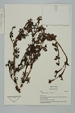
| Family | Rosaceae |
| Identification | Polylepis pepei B.B.Simpson |
| Determined by | T.E. Boza E. |
| Identification qualifier | |
| Field notes | Roadside and cultivated areas near houses. Tree 3 m. high. Cultivated in garden. Said be forming forest at higher altitudes. Cortex greyish-white to cream. |
|
 Other records of Polylepis pepei