AAU Herbarium Database |
| New Search Modify Search |
| Collector | Brandbyge, J. |
| Number | 511 |
| Collected with | |
| Country | Peru |
| Subpart | Puno |
| County | |
| Locality | Huancasayani between Abra Aricoma and Limbani. Roadside and cultivated areas near houses |
| Coordinates | 14° 13' S 69° 42' W |
| Minimum elevation (m) | 3750 |
| Maximum elevation (m) | 3750 |
| Start date | 1987/03/28 |
| End date | 1987/03/28 |
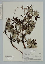
| Family | Rosaceae |
| Identification | Polylepis canoi W. Mend. |
| Determined by | T. Boza & M. Kessler |
| Identification qualifier | |
| Field notes | Tree 5 m high. Cultivated near houses. Said to be only existing as cultivated in this zone. Cortex reddish brown |
| |
 Other records of Polylepis canoi Other records of Polylepis canoiThe map displays only records from the Aarhus Herbarium Database. The records may not represent the full distribution of Polylepis canoi |
| New Search Modify Search |