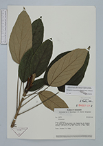
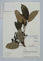
| Collector | Brandbyge, J. |
| Number | 42875 |
| Collected with | Jorgensen, P. M. |
| Country | Ecuador |
| Subpart | COTOPAXI |
| County | |
| Locality | 7 km from the point where the Ingapirca el Corazon road divides from the Angamarca road. Upper andean forest. |
| Coordinates | 1° 7' S 78° 55' W |
| Minimum elevation (m) | 3590 |
| Maximum elevation (m) | 3590 |
| Start date | 1984/11/11 |
| End date | 1984/11/11 |
| Family | Araliaceae |
| Identification | Oreopanax avicenniifolius (Kunth)Decne. & Planch. |
| Determined by | Borchsenius, F. (AAU), 1997. |
| Identification qualifier | |
| Field notes | Tree, slender 4 m high. |
|
 Other records of Oreopanax avicenniifolius