AAU Herbarium Database |
| New Search Modify Search |
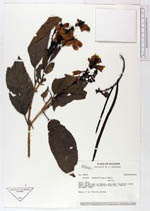
| Collector | Brandbyge, J. |
| Number | 42359 |
| Collected with | |
| Country | Ecuador |
| Subpart | LOJA |
| County | |
| Locality | About 10 km east of Celica. Dry open deciduous wood land vegetation. |
| Coordinates | 4° 5' S 79° 50' W |
| Minimum elevation (m) | 1050 |
| Maximum elevation (m) | 1050 |
| Start date | 1983/09/28 |
| End date | 1983/09/28 |
| Family | Bignoniaceae |
| Identification | Tecoma castanifolia (D. Don)Melch. |
| Determined by | |
| Identification qualifier | |
| Field notes | Shrub, 3 m. Corolla yellow. |

| |
 Other records of Tecoma castanifolia Other records of Tecoma castanifoliaThe map displays only records from the Aarhus Herbarium Database. The records may not represent the full distribution of Tecoma castanifolia |
| New Search Modify Search |