AAU Herbarium Database |
| New Search Modify Search |
| Collector | Brandbyge, J. |
| Number | 42340 |
| Collected with | |
| Country | Ecuador |
| Subpart | LOJA |
| County | |
| Locality | About 15 km east of Alamor on the road to Celica. Remnants of mountain forest. |
| Coordinates | 4° 6' S 79° 58' W |
| Minimum elevation (m) | 1850 |
| Maximum elevation (m) | 1850 |
| Start date | 1983/09/28 |
| End date | 1983/09/28 |
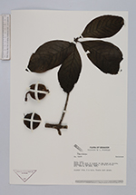
| Family | Rubiaceae |
| Identification | Randia |
| Determined by | Taylor, C.M. (MO), 1995. |
| Identification qualifier | |
| Field notes | Slender tree, 6 m tall. Fruits dark green. |
| |
| Display all 45 georeferenced records of Randia Randia |
| New Search Modify Search |