AAU Herbarium Database |
| New Search Modify Search |
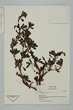
| Collector | Brandbyge, J. |
| Number | 351 |
| Collected with | |
| Country | Peru |
| Subpart | Apurimac |
| County | |
| Locality | Rio Cotaruse, ca. 10 km. Above Cotaruse. |
| Coordinates | 14° 28' S 73° 14' W |
| Minimum elevation (m) | 3550 |
| Maximum elevation (m) | 3550 |
| Start date | 1987/03/14 |
| End date | 1987/03/14 |
| Family | Rosaceae |
| Identification | Polylepis incana H.B.K. |
| Determined by | T.E. Boza E. |
| Identification qualifier | |
| Field notes | Steep slope leading down to the river. Tree 6 m. high. Growing along small river. |
| |
| Display all 94 georeferenced records of Polylepis Polylepis incana |
| New Search Modify Search |