AAU Herbarium Database |
| New Search Modify Search |
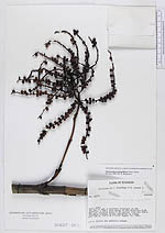
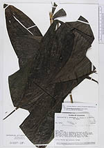
| Collector | Brandbyge, J. |
| Number | 32759 |
| Collected with | Asanza, E. |
| Country | Ecuador |
| Subpart | NAPO |
| County | |
| Locality | Río Wai si ayá, a northern tributary to Río Aguarico. A small path going in the direction E-SE. The path situated about 6 km upriver from San Pablo. Inundated primary forest dominated by palms. |
| Coordinates | 0° 15' S 76° 21' W |
| Minimum elevation (m) | 300 |
| Maximum elevation (m) | 300 |
| Start date | 1980/08/10 |
| End date | 1980/08/10 |
| Family | Arecaceae |
| Identification | Chamaedorea pinnatifrons (Jacq.)Oerst. |
| Determined by | B. Bergmann |
| Identification qualifier | |
| Field notes | 1.6 m. Fruits and peduncle orange. |
| |
| Display all 228 georeferenced records of Chamaedorea Chamaedorea pinnatifrons |
| New Search Modify Search |