| Collector | Brandbyge, J. |
| Number | 280 |
| Collected with | |
| Country | Peru |
| Subpart | Ayacucho |
| County | |
| Locality | Señal Cerro Palmaderas. Ca. 80 km above Nazca on the road to Poquio |
| Coordinates | 14° 40' S 74° 29' W |
| Minimum elevation (m) | 3900 |
| Maximum elevation (m) | 3900 |
| Start date | 1987/03/11 |
| End date | 1987/03/11 |
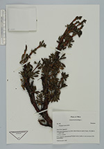
| Family | Rosaceae |
| Identification | Polylepis fjeldsaoi T.Boza & M.Kessler |
| Determined by | T. Boza & M. Kessler |
| Identification qualifier | |
| Field notes | Puna vegetation with scattered Polylepis scrub, mostly on rocky outcrops of old basalt blocks. Small tree 3.5 m high |
|
 Other records of Polylepis fjeldsaoi