AAU Herbarium Database |
| New Search Modify Search |
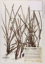
| Collector | Betancur, J. |
| Number | 613 |
| Collected with | F.J. Roldan & G. Castano |
| Country | Colombia |
| Subpart | Antioquia |
| County | |
| Locality | Municipio de San Luis: 12.4 Kms. de la entrada de San Luis hacia Medellín, Cordillera Central, ladera Oriental, Autopista Medellin-Bogota, bosque 500 mts. mas adentro, bmh-T |
| Coordinates | 50° 59' N 74° 59' W |
| Minimum elevation (m) | 800 |
| Maximum elevation (m) | 800 |
| Start date | 1988/09/15 |
| End date | 1988/09/15 |
| Family | Cyperaceae |
| Identification | Calyptrocarya |
| Determined by | |
| Identification qualifier | |
| Field notes | Hierba terrestre, en el sotobosque, abundante, envés de las hojas color vináceo, espigas cafe a verde. |
| |
 Other records of Calyptrocarya Other records of CalyptrocaryaThe map displays only records from the Aarhus Herbarium Database. The records may not represent the full distribution of Calyptrocarya |
| New Search Modify Search |