AAU Herbarium Database |
| New Search Modify Search |
| Collector | Nielsen, I. |
| Number | 1024 |
| Collected with | H.Balslev |
| Country | Brunei |
| Subpart | Temburong |
| County | |
| Locality | Temburong. District Kuala belalong Field Studies center, Batu Apoi Forest reserve, setap shale information. Ridge SW of Belalong Camp. Hill dipterocarp forest. Springs of S Semabat. |
| Coordinates | 4° 33' N 115° 9' E |
| Minimum elevation (m) | 300 |
| Maximum elevation (m) | 300 |
| Start date | 1991/03/07 |
| End date | 1991/03/07 |
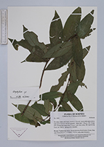
| Family | Rubiaceae |
| Identification | Urophyllum Wall. |
| Determined by | |
| Identification qualifier | |
| Field notes | On ridge; shade, soil clayey, shrub ca. 1.5 m tall. Leaves dark green above, light green beneath; flowers greenish - fruits dark. |
| |
| Display all 41 georeferenced records of Urophyllum Urophyllum |
| New Search Modify Search |