| Collector | Tuomisto, H. |
| Number | 4771 |
| Collected with | K.Ruokolainen, A.Layche, R.Ríos, A.Torres, A.Sarmiento |
| Country | Peru |
| Subpart | Maynas |
| County | |
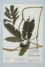
| Locality | Región Loreto. Primary rain forest in a moist valley of a creek on rather flat clayey terrain ca. 10 m above the level of Quebrada Paparo. Ca. 7 km east of the oil palm plantation at Río Manití. |
| Coordinates | 3° 38' S 72° 56' W |
| Minimum elevation (m) | 0 |
| Maximum elevation (m) | 0 |
| Start date | 1992/08/28 |
| End date | 1992/08/28 |
| Family | Blechnaceae |
| Identification | Salpichlaena hookeriana (Kuntze) Alston |
| Determined by | |
| Identification qualifier | |
| Field notes | Has long climbing runners. |
|
 Other records of Salpichlaena hookeriana