AAU Herbarium Database |
| New Search Modify Search |
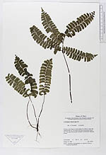
| Collector | Tuomisto, H. |
| Number | 4741 |
| Collected with | et al. |
| Country | Peru |
| Subpart | Loreto |
| County | |
| Locality | Primary rain forest in a moist valley of a creek on rather flat clayey terrain ca. 10 m above the level of quebrada Paparo. Ca. 7 km east of the oil palm plantation at Rio Maniti. Maynas |
| Coordinates | 3° 38' S 72° 56' W |
| Minimum elevation (m) | 0 |
| Maximum elevation (m) | 0 |
| Start date | 1992/08/16 |
| End date | 1992/08/16 |
| Family | Dennstaedtiaceae |
| Identification | Lindsaea divaricata Kl. |
| Determined by | Tuomisto,H. |
| Identification qualifier | |
| Field notes | |
| |
 Other records of Lindsaea divaricata Other records of Lindsaea divaricataThe map displays only records from the Aarhus Herbarium Database. The records may not represent the full distribution of Lindsaea divaricata |
| New Search Modify Search |