AAU Herbarium Database |
| New Search Modify Search |
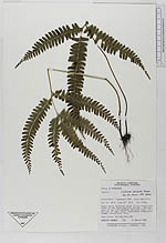
| Collector | Thomas, H. |
| Number | 570 |
| Collected with | |
| Country | Honduras |
| Subpart | Comayagua |
| County | |
| Locality | Terrestrial; commonDense moist hardwood cloud forest along both sides of the Agua Amarilla stream. Nuclear zone of the Azul Meambar National Park, 10.5 km east of Lago Yojoa, Department Comayagua. Common terrestrial fern |
| Coordinates | 14° 18' N 87° 52' W |
| Minimum elevation (m) | 1740 |
| Maximum elevation (m) | 1740 |
| Start date | 1993/03/11 |
| End date | 1993/03/11 |
| Family | Dennstaedtiaceae |
| Identification | Lindsaea arcuata Kunze |
| Determined by | |
| Identification qualifier | |
| Field notes | |
| |
 Other records of Lindsaea arcuata Other records of Lindsaea arcuataThe map displays only records from the Aarhus Herbarium Database. The records may not represent the full distribution of Lindsaea arcuata |
| New Search Modify Search |