AAU Herbarium Database |
| New Search Modify Search |
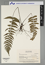
| Collector | Navarrete, H. |
| Number | 531 |
| Collected with | |
| Country | Ecuador |
| Subpart | NAPO |
| County | |
| Locality | Carretero Tena - Salcedo (no terminado), 5 km desde la punta. Sendero a Verde Yacu. |
| Coordinates | 1° 3' S 78° 54' W |
| Minimum elevation (m) | 650 |
| Maximum elevation (m) | 650 |
| Start date | 1993/08/06 |
| End date | 1993/08/06 |
| Family | Dryopteridaceae |
| Identification | Diplazium bombonasae Rosenst. |
| Determined by | Øllgaard,B. |
| Identification qualifier | |
| Field notes | Sobre rocas, quebrada oscura, común |
| |
 Other records of Diplazium bombonasae Other records of Diplazium bombonasaeThe map displays only records from the Aarhus Herbarium Database. The records may not represent the full distribution of Diplazium bombonasae |
| New Search Modify Search |