AAU Herbarium Database |
| New Search Modify Search |
| Collector | Moore,Jr., H.E. |
| Number | 8106 |
| Collected with | |
| Country | Mexico |
| Subpart | Oaxaca |
| County | |
| Locality | Ravine 35 km east of Mathias Romero, 4 km west of Palomares on trans-isthmus highway |
| Coordinates | |
| Minimum elevation (m) | 0 |
| Maximum elevation (m) | 0 |
| Start date | 1959/10/10 |
| End date | 1959/10/10 |
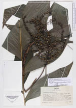
| Family | Arecaceae |
| Identification | Chamaedorea pinnatifrons (Jacq.)Oerst. |
| Determined by | Cueuca, A. |
| Identification qualifier | |
| Field notes | Single stemmed, to 5-7 ft. over-all. Leaves spreading, rachis somewhat pale but not whitish below, pinnae rather glossy above, duller but scarcely pale below. Inflorescence pendulous, orange, the glabose fruits orange-yellow (mature?), green when inmature. |
| |
| This record has no coordinates. Display map with the 228 georeferenced records of Chamaedorea pinnatifrons in the AAU Herbarium Database. |
| New Search Modify Search |