AAU Herbarium Database |
| New Search Modify Search |
| Collector | Moore,Jr., H.E. |
| Number | 8075 |
| Collected with | |
| Country | Mexico |
| Subpart | Campeche |
| County | |
| Locality | By road in thin woods on sandy soil near the sea, about 32 km from Paso Real on road to Champton. |
| Coordinates | |
| Minimum elevation (m) | 0 |
| Maximum elevation (m) | 0 |
| Start date | 1959/10/02 |
| End date | 1959/10/02 |
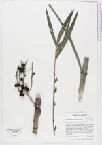
| Family | Arecaceae |
| Identification | Chamaedorea seifrizii Burret |
| Determined by | Bernal, R.; Galeano, G. |
| Identification qualifier | |
| Field notes | Clumps to 10 or more stems, to 5-8 ft high, very slender to stout, green, rachis orange, fruit green then dull black at maturity. Leaves glossy dark green above, paler below. |
| |
| This record has no coordinates. Display map with the 20 georeferenced records of Chamaedorea seifrizii in the AAU Herbarium Database. |
| New Search Modify Search |