| Collector | Moore,Jr., H.E. |
| Number | 8066 |
| Collected with | |
| Country | Mexico |
| Subpart | Veracruz |
| County | |
| Locality | About 20 km beyond Nanchitla between Cheapa and Agua Dulce on road to Villahermosa. |
| Coordinates | |
| Minimum elevation (m) | 0 |
| Maximum elevation (m) | 0 |
| Start date | 1959/09/29 |
| End date | 1959/09/29 |
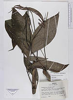
| Family | Arecaceae |
| Identification | Chamaedorea oblongata Mart. |
| Determined by | Bernal, R.; Galeano, G. |
| Identification qualifier | |
| Field notes | Stems solitary. Flowers and inflorescence green at time of collection. In wooded ravine above small stream with Bactris sp. And Genoma sp. |
|