AAU Herbarium Database |
| New Search Modify Search |
| Collector | Moore,Jr., H.E. |
| Number | 6215 |
| Collected with | Cetto, M. |
| Country | Mexico |
| Subpart | Veracruz |
| County | |
| Locality | Moist, shaded, steep, narrow ravine near km 331 about 1 km before Forint de las Flores on road from Tehuacán to Orizaba. |
| Coordinates | |
| Minimum elevation (m) | 0 |
| Maximum elevation (m) | 0 |
| Start date | 1952/04/06 |
| End date | 1952/04/06 |
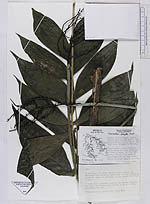
| Family | Arecaceae |
| Identification | Chamaedorea oblongata Mart. |
| Determined by | |
| Identification qualifier | |
| Field notes | Very slender, single-stemmed palms erect or often decumbent on steep slopes, 4-6 ft high, green. Leaves 3-7, erect or spreading with few deep green, glossy leathery arcuate laeflets. Female spadices 1 or more, generally below leaves or rupturing old sheathes, erect with stiffish spreading branches, green at authentic, bright orange with black fruit. Male erect with spreading branches and golden flowers, the branches dropping and slender in age with often persistent flowers. Common on steep slopes with 6216 and 6217. |
| |
| This record has no coordinates. Display map with the 11 georeferenced records of Chamaedorea oblongata in the AAU Herbarium Database. |
| New Search Modify Search |