AAU Herbarium Database |
| New Search Modify Search |
| Collector | Moore,Jr., H.E. |
| Number | 6592 |
| Collected with | |
| Country | Costa Rica |
| Subpart | Heredia |
| County | |
| Locality | Wooded area between Chilomate and La Virgen, valley of the Rio Sarapiqui. |
| Coordinates | |
| Minimum elevation (m) | 160 |
| Maximum elevation (m) | 160 |
| Start date | 1953/03/25 |
| End date | 1953/03/25 |
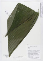
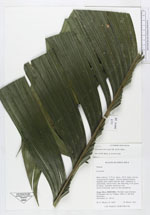
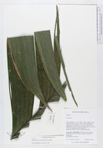
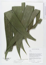
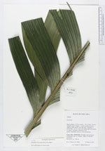
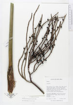
| Family | Arecaceae |
| Identification | Geonoma interrupta (Ruiz & Pav.)Mart. |
| Determined by | |
| Identification qualifier | |
| Field notes | Stem solitary, 2.75 in. diam., 18 ft. high, brown, conspicuously ringed. Leaves medium green, slightly paler below but not dull. Spadices 3, infrafoliar, red in fruit, the maturing fruit green to black, branches numerous andmuch-branched, more or less pendulous |
| |
| This record has no coordinates. Display map with the 35 georeferenced records of Geonoma interrupta in the AAU Herbarium Database. |
| New Search Modify Search |