AAU Herbarium Database |
| New Search Modify Search |
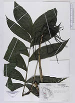
| Collector | Moore,Jr., H.E. |
| Number | 6308 |
| Collected with | O'Gorman, H. |
| Country | Mexico |
| Subpart | Veracruz |
| County | |
| Locality | Slopes of ravine about 3 miles beyond Papantla on road to Poza Rica |
| Coordinates | |
| Minimum elevation (m) | 240 |
| Maximum elevation (m) | 240 |
| Start date | 1952/04/19 |
| End date | 1952/04/19 |
| Family | Arecaceae |
| Identification | Chamaedorea oblongata Mart. |
| Determined by | |
| Identification qualifier | |
| Field notes | |
| |
| This record has no coordinates. Display map with the 11 georeferenced records of Chamaedorea oblongata in the AAU Herbarium Database. |
| New Search Modify Search |