| Collector | Balslev, H. |
| Number | 9873 |
| Collected with | Voradol Chamchumroom, Witsanu Saisorn, Pirada Sumanon & Suwat Suwanachat |
| Country | Thailand |
| Subpart | Mae Hong Son province |
| County | |
| Locality | Mae Hong Son district. Nam Tak Mae Surin National Park. Mae Sakud waterfall rangerstation. 11 km south of Mae Hong Son along #108, then 3+ km to the east. Along nature trail 2,5 km loop partly along creek on steep rocky slopes. |
| Coordinates | 19° 15' 17'' N 97° 59' 40'' E |
| Minimum elevation (m) | 409 |
| Maximum elevation (m) | 616 |
| Start date | 2019/07/15 |
| End date | 2019/07/15 |
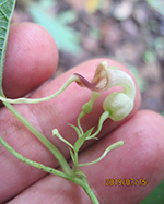
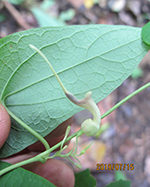
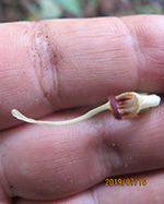
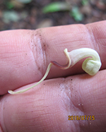
| Family | Aristolochiaceae |
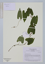
| Identification | Aristolochia tagala Cham. |
| Determined by | |
| Identification qualifier | ? |
| Field notes | Vine creeping on shrub. |
|
 Other records of Aristolochia tagala