AAU Herbarium Database |
| New Search Modify Search |
| Collector | Balslev, H. |
| Number | 8502 |
| Collected with | D. Pedersen, L.B. Thostrup, E.L. Tagø, I.M. Østergaard, J. Jensen & C. Grández |
| Country | Peru |
| Subpart | Loreto |
| County | |
| Locality | 229 km SW of Iquitos, 69 km SW of San Martín. Río Samiria, left bank going up. Primary forest on floodplain |
| Coordinates | 5° 14' 6'' S 74° 41' 1'' W |
| Minimum elevation (m) | 103 |
| Maximum elevation (m) | 0 |
| Start date | 2011/07/06 |
| End date | 2011/07/06 |
| Family | Arecaceae |
| Identification | Geonoma macrostachys var. acaulis (Mart.)A.J.Hend. |
| Determined by | Henrik Balslev |
| Identification qualifier | |
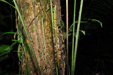
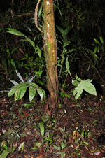
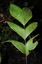
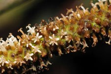
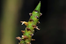
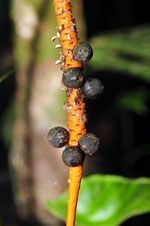
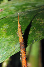
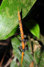
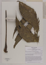
| Field notes | Solitary understory palm. Acaulecent. Leaves 14; sheath 20 cm long, open; petiole 70 cm long, section round; rachis 48 cm long; lamina pinnate, 60 cm long, 37 cm wide, flat, glabrous; pinnae 4 per side; basal pinna 24 cm long, middle pinna 29 cm long, apical pinna 25 cm long. Infructescence interfoliar; prophyll 10 cm long, 0.5 cm wide, papery; peduncular bract 21 cm long, inserted at base, brown, papery; peduncle 50 cm long, 0.3 cm wide; spike 16 cm long, 1 cm wide. Flowers white, sunken. Silica gel sample taken. Transect: HB 476, subunit no. 73, inside transect |
| |
| Display all 211 georeferenced records of Geonoma Geonoma macrostachys var. acaulis |
| New Search Modify Search |