AAU Herbarium Database |
| New Search Modify Search |
| Collector | Balslev, H. |
| Number | 8489 |
| Collected with | D. Pedersen, L.B. Thostrup, E.L. Tagø, I.M. Østergaard, J. Jensen & C. Grández |
| Country | Peru |
| Subpart | Loreto |
| County | |
| Locality | 163 km SW of Iquitos, 5 km NW of San Martín. Río Samiria. NW corner of oxbow lake. Primary forest on floodplain |
| Coordinates | 4° 38' 9'' S 74° 25' 4'' W |
| Minimum elevation (m) | 117 |
| Maximum elevation (m) | 0 |
| Start date | 2011/07/02 |
| End date | 2011/07/02 |
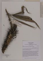
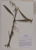
| Family | Arecaceae |
| Identification | Desmoncus horridus subsp. occidentalis A.J.Hend. |
| Determined by | H. Balslev |
| Identification qualifier | |
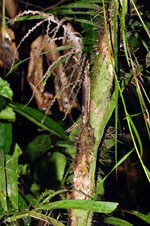
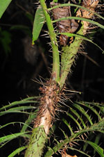
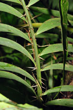
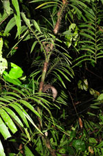
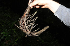
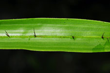
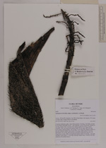
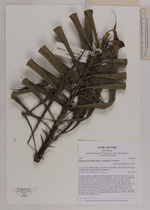
| Field notes | Cespitose understory palm. Liana. Stem smooth, 15 m long, 3 cm thick, covered by leaf bases; internodes 20 cm, > stem diameter. Leaves 20 per stem; sheath 40+ cm long, closed, with 3 cm long brown spines; petiole 10 cm long, section margined, with 3 cm long brown spines; rachis 140 cm long, with 2 cm long brown spines; lamina pinnate, 150 cm long, 70 cm wide, flat, glabrous; pinnae 30 per side, insertion regular; basal pinna 25 cm long, middle pinna 35 cm long, apical pinna 18 cm long. Infructescence interfoliar; peduncular bract 40+ cm long, brown, woody, with 2 cm long brown spines; rachis 15 cm long, 1 cm wide; rachillae 15 per rachis, 5-15 cm long. Silica gel sample taken. Transect: HB 468, subunit no. 80, inside transect |

| |
 Other records of Desmoncus horridus subsp. occidentalis Other records of Desmoncus horridus subsp. occidentalisThe map displays only records from the Aarhus Herbarium Database. The records may not represent the full distribution of Desmoncus horridus subsp. occidentalis |
| New Search Modify Search |