AAU Herbarium Database |
| New Search Modify Search |
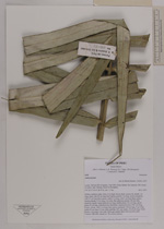
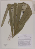
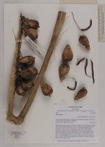
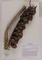
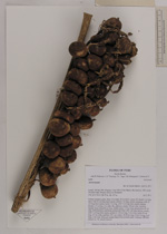
| Collector | Balslev, H. |
| Number | 8488 |
| Collected with | D. Pedersen, L.B. Thostrup, E.L. Tagø, I.M. Østergaard, J. Jensen & C. Grández |
| Country | Peru |
| Subpart | Loreto |
| County | |
| Locality | 163 km SW of Iquitos, 5 km NW of San Martín. Río Samiria. NW corner of oxbow lake. Primary forest on floodplain |
| Coordinates | 4° 38' 9'' S 74° 25' 4'' W |
| Minimum elevation (m) | 117 |
| Maximum elevation (m) | 0 |
| Start date | 2011/07/02 |
| End date | 2011/07/02 |
| Family | Arecaceae |
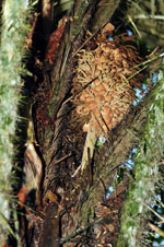
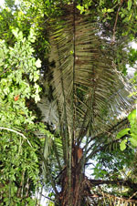
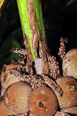
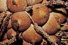
| Identification | Astrocaryum |
| Determined by | Henrik Balslev |
| Identification qualifier | |
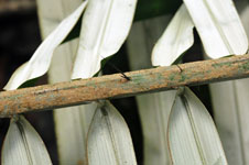
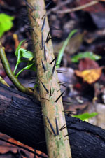
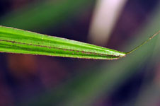
| Field notes | Solitary midstory palm. Stem 12 m high, 20 cm thick. Leaves 20; sheath 1 m long, open, with 30 cm long black spines; petiole 3 m long, section margined, with 15 cm long black spines; rachis 5 m long, with 5 cm long black spines; lamina pinnate, 5.5 m long, 2 m wide, flat, glabrous; pinnae 120 per side, insertion regular; basal pinna 60 cm long, middle pinna 110 cm long, apical pinna 40 cm long. Infructescence interfoliar; peduncular bract 100+ cm long, brown, woody, with 5 cm long black spines; peduncle 120 cm long, 5 cm wide; rachis 45 cm long, 3.5 cm wide; rachillae 100+ per rachis, 10-20 cm long. Fruits brown, 4 cm long, 3 cm wide. Silica gel sample taken from juvenile palm. Transect: HB 468, subunit no. 78, outside transect |

| |
 Other records of Astrocaryum Other records of AstrocaryumThe map displays only records from the Aarhus Herbarium Database. The records may not represent the full distribution of Astrocaryum |
| New Search Modify Search |