AAU Herbarium Database |
| New Search Modify Search |
| Collector | Balslev, H. |
| Number | 8481 |
| Collected with | D. Pedersen, L.B. Thostrup, E.L. Tagø, I.M. Østergaard, J. Jensen & C. Grández |
| Country | Peru |
| Subpart | Loreto |
| County | |
| Locality | 166 km SW of Iquitos, 1.5 km SW of San Martín. Río Samiria. SW bank of oxbow lake. Primary forest on floodplain |
| Coordinates | 4° 42' 0'' S 74° 24' 7'' W |
| Minimum elevation (m) | 109 |
| Maximum elevation (m) | 0 |
| Start date | 2011/06/30 |
| End date | 2011/06/30 |
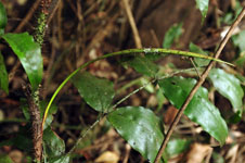
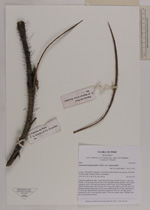
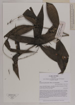
| Family | Arecaceae |
| Identification | Desmoncus polyacanthos var. polyacanthos Mart. |
| Determined by | Henrik Balslev |
| Identification qualifier | |
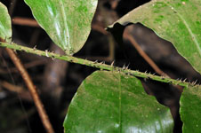
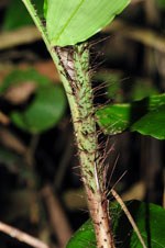
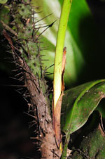
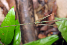
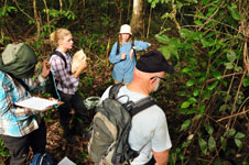
| Field notes | Cespitose understory palm. Liana. Stem 28 m long, smooth. Leaves 11 per stem; sheath 15-20 cm long, closed, with 2 mm long black spines; petiole 4 cm, section margined, with 5 mm long black spines; rachis 50 cm, with 5 mm long black spines; lamina pinnate, 60 cm long, 30 cm wide, flat, glabrous; pinnae 6 per side, insertion regular; basal pinna 16 cm long, middle pinna 20 cm long, apical pinna 17 cm long. Infructescence interfoliar; peduncular bract 30+ cm long, green, herbaceous, with 1 mm long black spines. Silica gel sample taken. Transect: HB 465, way out from transect |
| |
 Other records of Desmoncus polyacanthos var. polyacanthos Other records of Desmoncus polyacanthos var. polyacanthosThe map displays only records from the Aarhus Herbarium Database. The records may not represent the full distribution of Desmoncus polyacanthos var. polyacanthos |
| New Search Modify Search |