AAU Herbarium Database |
| New Search Modify Search |
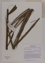
| Collector | Balslev, H. |
| Number | 8476 |
| Collected with | D. Pedersen, L.B. Thostrup, E.L. Tagø, I.M. Østergaard, J. Jensen & C. Grández |
| Country | Peru |
| Subpart | Loreto |
| County | |
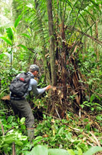
| Locality | 164 km SW of Iquitos, 8 km NW of San Martín. Río Samiria, right bank of river going up. Primary forest on floodplain |
| Coordinates | 4° 44' 6'' S 74° 21' 5'' W |
| Minimum elevation (m) | 116 |
| Maximum elevation (m) | 0 |
| Start date | 2011/06/28 |
| End date | 2011/06/28 |
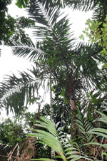
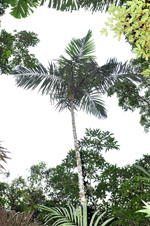
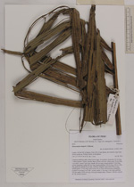
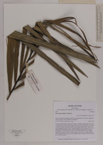
| Family | Arecaceae |
| Identification | Oenocarpus mapora H.Karst. |
| Determined by | Henrik Balslev |
| Identification qualifier | |
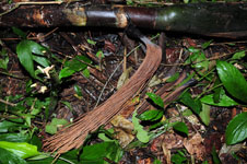
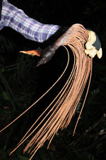
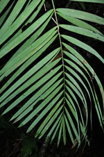
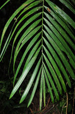
| Field notes | Cespitose midstory palm. Stem 8.40 m high, 10 cm thick; internodes 20 cm long, > stem diameter, brown, smooth. Base of stem with few visible roots, 16 cm long, 1 cm thick. Leaves 7 per stem; sheath 140 cm long, closed; petiole 12 cm long, section margined; rachis 405 cm long; lamina pinnate, 438 cm long, 200 cm wide, flat, glabrous; pinnae 85 per side, insertion irregular; basal pinna 98 cm long, middle pinna 113 cm long, apical pinna 34 cm long. Infructescence infrafoliar; prophyll 4 cm long, 9 cm wide, woody; rachis 11 cm long, 3 cm wide; rachillae 103 per rachis, 53-65 cm long. Silica gel sample taken. Transect: HB 461, subunit no. 28, outside transect |


| |
| Display all 59 georeferenced records of Oenocarpus Oenocarpus mapora |
| New Search Modify Search |