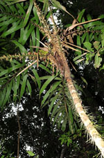
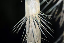
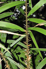
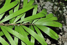
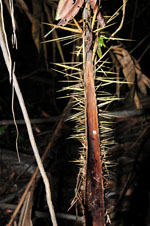
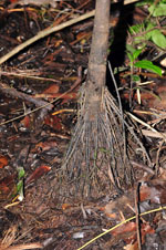
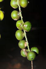
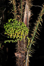
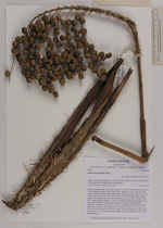
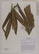
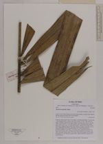
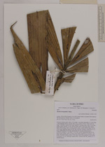
| Field notes | Colonial midstory palm. Stem 3.20 m high, 5 cm thick; internodes 13-16 cm long, > stem diameter, brown, smooth. Root cone, number of roots >100, 20-30 cm long, 5 mm thick. Leaves 9 per stem; sheath 41 cm long, open, with 1-3 cm long yellow spines; petiole 117 cm, section round, with 3-6 cm long yellow spines; rachis 106 cm long, with 3 cm long yellow spines; lamina 200 cm long, 114 cm wide, bushy, glabrous; pinnae 23 per side, insertion irregular; basal pinna 53 cm long, middle pinna 55 cm long, apical pinna 45 cm long. Infructescence interfoliar; prophyll 31 cm long, 3.5 cm wide, woody; peduncular bract 49 cm long, brown, woody, with 2 cm long yellow spines; peduncle 12 cm long, 1 cm wide, with yellow spines; rachis 14 cm long, 2 mm wide; rachillae 23 per rachis. Fruits green, 1x1 cm. Silica gel sample taken. Transect: HB 460, subunit no. 47, outside transect |