AAU Herbarium Database |
| New Search Modify Search |
| Collector | Balslev, H. |
| Number | 8456 |
| Collected with | M.V. Sørensen, A.K. Brunbjerg & C. Grández |
| Country | Peru |
| Subpart | Madre de Dios |
| County | |
| Locality | Tambopata province. 126 km W of Puerto Maldonado, 1.2 km SE of Santa Rosa, just south of Interoceanica nr 3. Primary forest on hills |
| Coordinates | 12° 55' 57.78'' S 70° 17' 31.26'' W |
| Minimum elevation (m) | 380 |
| Maximum elevation (m) | 380 |
| Start date | 2011/04/18 |
| End date | 2011/04/18 |
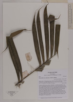
| Family | Arecaceae |
| Identification | Bactris hirta var. spruceana (Trail) A.J.Hend. |
| Determined by | Henrik Balslev |
| Identification qualifier | |
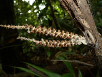
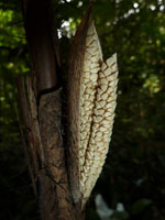
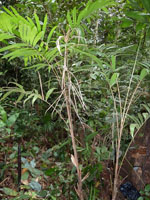
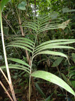
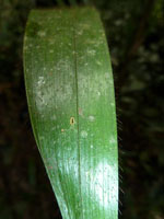
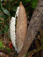
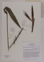
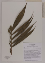
| Field notes | Cespitose understory palm. Stem 1.28 m high, 1.3 cm thick; internodes 11 cm long, > stem diameter, dark brown, smooth, covered by leaf bases. Leaves 6 per stem; sheath 24 cm long, closed, with 2 cm long, black spines; petiole 30 cm long, section softly margined; rachis 42 cm long; lamina pinnate, 55 cm long, 43 cm wide, flat, hairy; pinnae 15 per side, regularly inserted in groups of 1-5; basal pinna 25 cm long, middle pinna 29 cm long, apical pinna 22 cm long. Inflorescence infrafoliar; prophyll 9.3 cm long, 1 cm wide, papery; peduncular bract 14.5 cm long, inserted 1.1 cm from base, brown, papery, with 0.4 cm long, black spines; peduncle 9 cm long, 0.7 cm wide; rachillae 2 per rachis, 6.2-7.5 cm long. Flower cream colored, pedicilate. Silica gel sample taken. Transect: HB 449, subunit no. 33, inside transect |
| |
 Other records of Bactris hirta var. spruceana Other records of Bactris hirta var. spruceanaThe map displays only records from the Aarhus Herbarium Database. The records may not represent the full distribution of Bactris hirta var. spruceana |
| New Search Modify Search |