AAU Herbarium Database |
| New Search Modify Search |
| Collector | Balslev, H. |
| Number | 8448 |
| Collected with | M.V. Sørensen, A.K. Brunbjerg & C. Grández |
| Country | Peru |
| Subpart | Madre de Dios |
| County | |
| Locality | Tambopata province. 122 km W of Puerto Maldonado, 8.4 km N of Santa Rosa. Along Interoceanica nr 3. Primary forest on terrace |
| Coordinates | 12° 51' 9.42'' S 70° 16' 50.88'' W |
| Minimum elevation (m) | 290 |
| Maximum elevation (m) | 290 |
| Start date | 2011/04/16 |
| End date | 2011/04/16 |
| Family | Arecaceae |
| Identification | Attalea phalerata Mart. |
| Determined by | Henrik Balslev |
| Identification qualifier | |
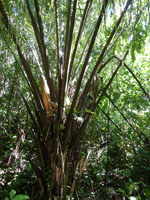
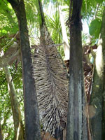
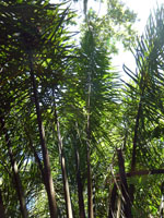
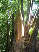
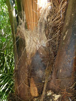
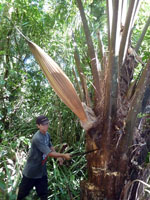
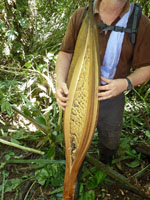
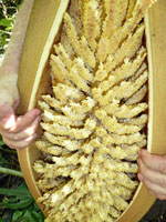
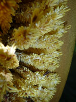
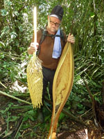
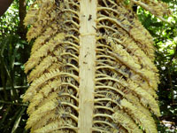
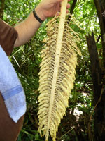
| Field notes | Solitary midstory palm. Stem 100 cm high, 60 cm thick, covered by leaf bases. Leaves 17 per stem; sheath 100 cm long, open; petiole 220 cm long, section margined; rachis 740 cm long; lamina pinnate, 770 cm long, 220 cm wide, bushy, glabrous; pinnae 230 per side, irregularly inserted in groups of 2-7; basal pinna 65 cm long, middle pinna 130 cm long, apical pinna 20 cm long. Inflorescence interfoliar; prophyll 50+ cm long, 20 cm wide, woody, fibrous apically; peduncular bract 175 cm long, brown, woody; peduncle 70 cm long, 4 cm wide; rachis 60 cm long, 2.5 cm wide; rachillae 320 per rachis. Flowers cream, sessile. Silica gel sample of flowers taken. Transect: HB 445, subunit no. 81, inside transect |
| |
 Other records of Attalea phalerata Other records of Attalea phalerataThe map displays only records from the Aarhus Herbarium Database. The records may not represent the full distribution of Attalea phalerata |
| New Search Modify Search |