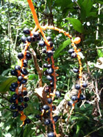
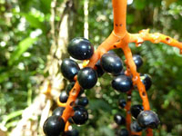
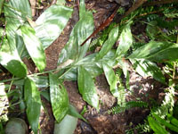
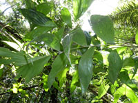
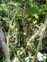
| Field notes | Solitary understory palm. Stem 118 cm long, 1.2 cm thick; internodes 6-8 cm long, > stem diameter, smooth, green; base of stem with 30+ visible roots, 9-12 cm long, 0.3 cm thick. Leaves 7 per stem; sheath 22 cm long, closed; petiole 18 cm long, section round; rachis 56 cm long; lamina pinnate, 72 cm long, 52 cm wide, flat, glabrous; pinnae 5 per side, insertion irregular; basal pinna 25 cm long, middle pinna 26 cm long, apical pinna 24 cm long. Infructescence infrafoliar; prophyll 3 cm long, 0.7 cm wide, papery; peduncular bracts 22 cm long, inserted 4, 5.5, 9.5, 19 cm from base, brown, papery; peduncle 33 cm long, 0.3 cm wide; rachis 3 cm long, 0.2 cm wide; rachillae 6 per rachis, 10-12 cm long. Silica gel sample taken. Transect: HB 445, subunit no. 7, inside transect |