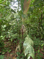
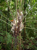
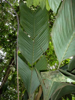
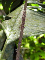
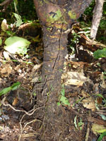
| Field notes | Solitary understory palm. Stem 31 cm long, 6 cm thick; internodes 0.5 cm long, < stem diameter, fissured/rough, brown; base of stem with few visible roots, 5 cm long, 0.5 cm thick. Leaves 15 per stem; sheath 16 cm long, open; petiole 52 cm long, section margined; rachis 55 cm long; lamina pinnate, 110 cm long, 35 cm wide, flat, glabrous; pinnae 3 per side; insertion regular; basal pinna 46 cm long, middle pinna 39 cm long, apical pinna 35 cm long. Infructescence interfoliar; prophyll 33.5 cm long, 3 cm wide; peduncular bract 33.5 cm long, inserted 0.2 cm from base, brown, papery; peduncle 107 cm long, 0.8 cm wide; rachis 37 cm long, 1 cm wide. Silica gel sample taken. Transect: HB 443, subunit no. 8, outside transect |