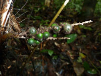
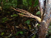
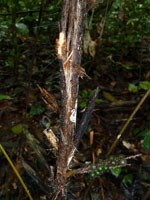
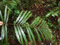
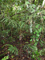
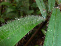
| Field notes | Solitary understory palm. Stem 26 cm long, 1.5 cm thick; internodes 6 cm long, >stem diameter, brown, covered by leaf bases. Leaves 3 per stem; sheath 15 cm long, closed, with 1.2 cm long, black spines; petiole 41 cm long, with 3 cm long, brown spines; rachis 48 cm long; lamina pinnate, 62 cm long, 44 cm wide, flat, hairy; pinnae 10 per side, regularly inserted in groups of more than 2; basal pinna 24 cm long, middle pinna 22 cm long, apical pinna 16 cm long. Infructescence infrafoliar; prophyll 5.5 cm long, 2.2 cm wide, papery; peduncular bract 12.5 cm long, inserted 2 cm from base, brown, woody, with 0.3 cm long, brown spines; peduncle 5 cm long, 0.8 cm wide, with 0.2 cm long, brown spines; rachillae 3 per rachis, 3.5-5 cm long. Fruits 0.7 cm long, 0.8 cm wide, green. Silica gel sample taken. Transect: HB 435, subunit no. 3, inside transect |
 Other records of Bactris hirta var. spruceana