AAU Herbarium Database |
| New Search Modify Search |
| Collector | Balslev, H. |
| Number | 8417 |
| Collected with | D. Pedersen, M.V. Sørensen, A.K. Brunbjerg & C. Grández |
| Country | Peru |
| Subpart | Madre de Dios |
| County | |
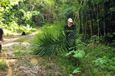
| Locality | Tahuamanu province. 148 km N of Puerto Maldonado, 39 km S of Iñapari. Along Interoceanica nr 1. Primary forest on tierra firme |
| Coordinates | 11° 17' 34.02'' S 69° 30' 56.82'' W |
| Minimum elevation (m) | 319 |
| Maximum elevation (m) | 319 |
| Start date | 2011/04/07 |
| End date | 2011/04/07 |
| Family | Arecaceae |
| Identification | Syagrus sancona Karsten |
| Determined by | Henrik Balslev |
| Identification qualifier | |
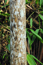
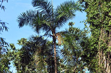
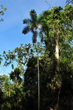
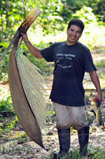
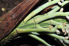
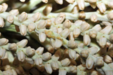
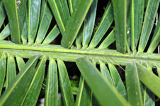
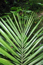
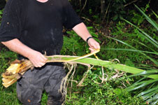
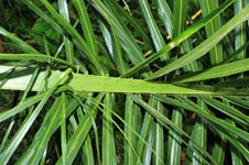
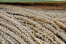
| Field notes | Solitary midstory palm. Stem 14 m long, 12-13 cm thick, grey, smooth; apical internode 8 cm long. Leaves 10 per stem; sheath 20 cm long; petiole 100 cm long, 5-10 cm wide, section margined; lamina pinnate; 310 cm long, 150 cm wide, bushy, glabrous; pinnae 190 per side, regularly inserted in groups of 2-5; basal pinna 45 cm long, middle pinna 80 cm long, apical pinna 20 cm long. Inflorescence interfoliar; prophyll 70 cm long, 11 cm wide, woody; peduncular bract 175 cm long (immature 165 cm long), inserted 3 cm from base, brown (immature green), woody; peduncle 37 cm long, 5 cm wide; rachis 90 cm long (immature 55 cm long); rachillae >100, 30-70 cm long. Flowers cream, sessile. Silica gel sample taken. Transect: HB 434, to transect |
| |
 Other records of Syagrus sancona Other records of Syagrus sanconaThe map displays only records from the Aarhus Herbarium Database. The records may not represent the full distribution of Syagrus sancona |
| New Search Modify Search |