AAU Herbarium Database |
| New Search Modify Search |
| Collector | Balslev, H. |
| Number | 8412 |
| Collected with | D. Pedersen, M.V. Sørensen, A.K. Brunbjerg & C. Grández |
| Country | Peru |
| Subpart | Madre de Dios |
| County | |
| Locality | Tahuamanu province. 164 km N of Puerto Maldonado, 23 km S of Iñapari. Along Interoceanica nr 1. Primary forest on tierra firme |
| Coordinates | 11° 9' 23.82'' S 69° 33' 9.9'' W |
| Minimum elevation (m) | 308 |
| Maximum elevation (m) | 308 |
| Start date | 2011/04/06 |
| End date | 2011/04/06 |
| Family | Arecaceae |
| Identification | Attalea phalerata Mart. |
| Determined by | Henrik Balslev |
| Identification qualifier | |
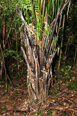
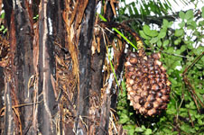
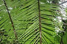
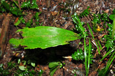
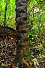
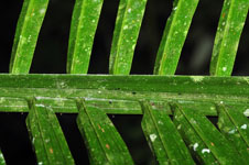
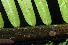
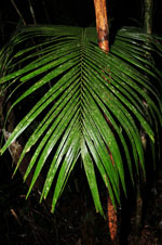
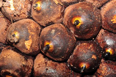
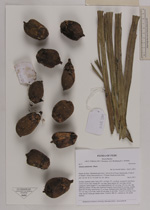
| Field notes | Solitary midstory palm. Stem 267+ cm high, 57+ cm thick; covered by leaf bases. Leaves 14 per stem; sheath 99+ cm long, open; petiole 20+ cm long, section margined; rachis length 473 cm; lamina pinnate, 497 cm long, 150 cm wide, flat, glabrous; pinnae 159 per side; insertion irregular; basal pinna 94 cm long, middle pinna 82 cm long, apical pinna 33 cm long. Infructescence interfoliar; peduncle 52+ cm long, 4 cm wide; rachis 45 cm long, 24 cm wide. Fruits 6.5 cm long, 4 cm wide, brown. Silica gel sample taken. Transect: HB 431, subunit no. 46, inside transect |
| |
 Other records of Attalea phalerata Other records of Attalea phalerataThe map displays only records from the Aarhus Herbarium Database. The records may not represent the full distribution of Attalea phalerata |
| New Search Modify Search |