AAU Herbarium Database |
| New Search Modify Search |
| Collector | Balslev, H. |
| Number | 8401 |
| Collected with | D. Pedersen, M.V. Sørensen, A.K. Brunbjerg & C. Grández |
| Country | Peru |
| Subpart | Madre de Dios |
| County | |
| Locality | Tahuamanu province. 176 km N of Puerto Maldonado, 11 km S of Iñapari. Along Interoceanica nr 1. Primary forest on tierra firme |
| Coordinates | 11° 2' 45.12'' S 69° 33' 51.84'' W |
| Minimum elevation (m) | 295 |
| Maximum elevation (m) | 295 |
| Start date | 2011/04/04 |
| End date | 2011/04/04 |
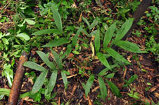
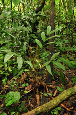
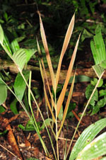
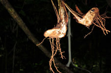
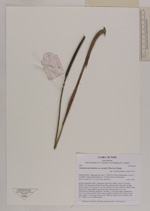
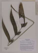
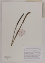
| Family | Arecaceae |
| Identification | Geonoma macrostachys var. acaulis (Mart.)A.J.Hend. |
| Determined by | Henrik Balslev |
| Identification qualifier | |
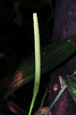
| Field notes | Solitary understory palm. Acaulecent. Roots few visible. Leaves 7 per stem; sheath 3 cm long, open; petiole 50 cm long, section round; rachis 20 cm long; lamina pinnate, 33 cm long, 35 cm wide; pinnae 3 per side, insertion regular; basal pinna 21 cm long, middle pinna 20 cm long; apical pinna 21 cm long. Inflorescence interfoliar; prophyll 9 cm long, 1.2 cm wide, papery; peduncular bract 22 cm long, inserted at base, brown, papery; peduncle 42 cm long, 0.6 cm wide; rachis 11.5 cm long, 0.8 cm wide. Silica gel sample taken. Transect: HB 427, subunit no. 30, inside transect |
| |
| Display all 211 georeferenced records of Geonoma Geonoma macrostachys var. acaulis |
| New Search Modify Search |