AAU Herbarium Database |
| New Search Modify Search |
| Collector | Balslev, H. |
| Number | 8389 |
| Collected with | D. Pedersen, M.V. Sørensen, A.K. Brunbjerg & C. Grández |
| Country | Peru |
| Subpart | Madre de Dios |
| County | |
| Locality | Tahuamanu province. 176 km N of Puerto Maldonado, 11 SW of Iñapari. Along Interoceanica nr 1. Primary forest on tierra firme |
| Coordinates | 11° 2' 40.74'' S 69° 32' 9.6'' W |
| Minimum elevation (m) | 204 |
| Maximum elevation (m) | 204 |
| Start date | 2011/04/02 |
| End date | 2011/04/02 |
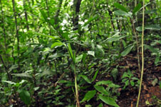
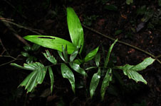
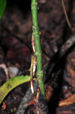
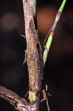
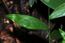
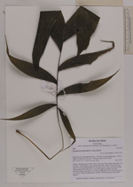
| Family | Arecaceae |
| Identification | Chamaedorea pinnatifrons (Jacq.)Oerst. |
| Determined by | Henrik Balslev |
| Identification qualifier | |
| Field notes | Solitary understory palm. Sterile. Stem 52 cm long, 0.8 cm thick; internodes 3.5-4 cm long, > stem diameter, green, smooth. Roots few visible. Leaves 4 per stem; sheath 10 cm long, closed; petiole 15 cm long, section round; rachis 20 cm long; lamina pinnate, 38 cm long, 28 cm wide, flat, glabrous; pinnae 4 per side, insertion irregular; basal pinna 13 cm long, middle pinna 16 cm long, apical pinna 21 cm long. Silica gel sample taken. Transect: HB 423, subunit no. 86, inside transect |
| |
| Display all 228 georeferenced records of Chamaedorea Chamaedorea pinnatifrons |
| New Search Modify Search |