AAU Herbarium Database |
| New Search Modify Search |
| Collector | Balslev, H. |
| Number | 8385 |
| Collected with | D. Pedersen, M.V. Sørensen, A.K. Brunbjerg & C. Grández |
| Country | Peru |
| Subpart | Madre de Dios |
| County | |
| Locality | Tambopata province. 41 km E of Puerto Maldonado, 3.1 km W of Palma Real. Reserva Tambopata, south bank of Río Madre de Dios. Primary forest on terrace |
| Coordinates | 12° 31' 9.24'' S 68° 48' 23.28'' W |
| Minimum elevation (m) | 202 |
| Maximum elevation (m) | 202 |
| Start date | 2011/03/29 |
| End date | 2011/03/29 |
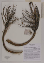
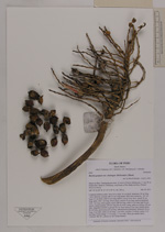
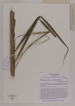
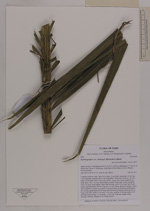
| Family | Arecaceae |
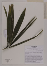
| Identification | Bactris gasipaes var. chichagui (H.Karst)A.J.Hend. |
| Determined by | Henrik Balslev |
| Identification qualifier | |
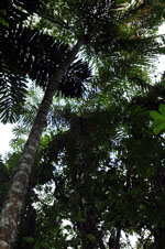
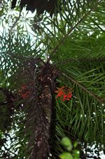
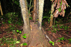
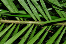
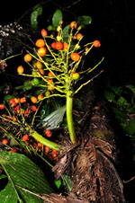
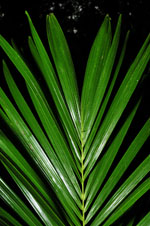
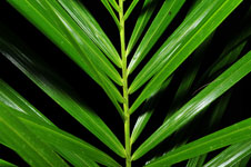
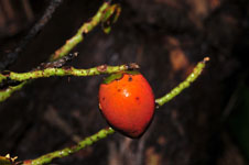
| Field notes | Cespitose midstory palm. Stem 9.6 m high, 16 cm thick; internodes 18 cm long, >stem diameter, smooth with 3.5 cm long spines. Stilt roots numerous, 20+ cm long, 0.5 cm thick, with 0.5 cm long, spines. Leaves 8 per stem; sheath 30 cm long, open, with 1 cm long, black spines; petiole 70 cm long, section margined, with 1 cm long, black spines; rachis 280 cm long, with 0.5 cm long, light brown spines; lamina pinnate, 290 cm long, 80 cm wide, bushy, glabrous; pinnae 120 per side, irregularly inserted in groups of 3-6; basal pinna 35 cm long; middle pinna 60 cm long; apical pinna 22 cm long. Infructescence infrafoliar; peduncle 28 cm long, 3 cm wide; rachis 12 cm long, 1 cm wide; rachillae 35-40 per rachis, 5-15 cm long. Fruits orange, 2.5 cm long, 1.7 cm wide. Silica gel sample taken. Transect: HB 421, subunit no. 83, inside transect |
| |
 Other records of Bactris gasipaes var. chichagui Other records of Bactris gasipaes var. chichaguiThe map displays only records from the Aarhus Herbarium Database. The records may not represent the full distribution of Bactris gasipaes var. chichagui |
| New Search Modify Search |