AAU Herbarium Database |
| New Search Modify Search |
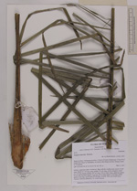
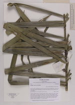
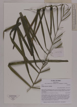
| Collector | Balslev, H. |
| Number | 8376 |
| Collected with | D. Pedersen, M.V. Sørensen, A.K. Brunbjerg & C. Grández |
| Country | Peru |
| Subpart | Madre de Dios |
| County | |
| Locality | Tambopata province. 41 km E of Puerto Maldonado, 3.2 km W of Palma Real. Reserva Tambopata, on island in Río Madre de Dios. Primary forest on floodplain |
| Coordinates | 12° 30' 36.24'' S 68° 48' 26.46'' W |
| Minimum elevation (m) | 181 |
| Maximum elevation (m) | 181 |
| Start date | 2011/03/27 |
| End date | 2011/03/27 |
| Family | Arecaceae |
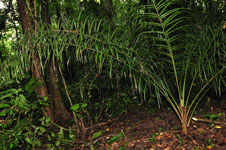
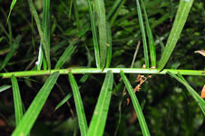
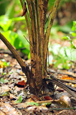
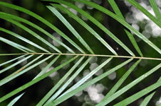
| Identification | Syagrus sancona Karsten |
| Determined by | Henrik Balslev |
| Identification qualifier | |
| Field notes | Solitary understory palm. Acaulecent. Base with few visible roots. Leaves 10 per stem; sheath 21+ cm long, open; petiole 101 cm long, section margined; rachis 274 cm long; lamina pinnate, 287 cm long, 118 cm wide, bushy, glabrous; pinnae 92 per side, insertion regular, in groups of 2-4; basal pinna 45 cm long, middle pinna 52 cm long, apical pinna 30 cm long. Juvenile. Silica gel sample taken. Transect: HB 416, subunit no. 53, inside transect |
| |
 Other records of Syagrus sancona Other records of Syagrus sanconaThe map displays only records from the Aarhus Herbarium Database. The records may not represent the full distribution of Syagrus sancona |
| New Search Modify Search |