AAU Herbarium Database |
| New Search Modify Search |
| Collector | Balslev, H. |
| Number | 8363 |
| Collected with | D. Pedersen, M.V. Sørensen, A.K. Brunbjerg & C. Grández |
| Country | Peru |
| Subpart | Madre de Dios |
| County | |
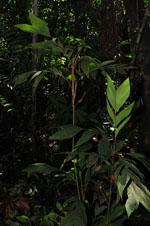
| Locality | Tambopata province. 39 km E of Puerto Maldonado, 5.4 km W of Palma Real. Reserva Tambopata, south bank of Río Madre de Dios. Primary forest tierra firme |
| Coordinates | 12° 30' 56.52'' S 68° 49' 40.38'' W |
| Minimum elevation (m) | 206 |
| Maximum elevation (m) | 206 |
| Start date | 2011/03/25 |
| End date | 2011/03/25 |
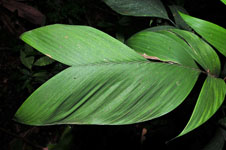
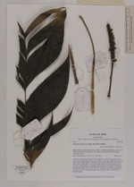
| Family | Arecaceae |
| Identification | Geonoma stricta var. trailii (Burret)A.J.Hend. |
| Determined by | Henrik Balslev |
| Identification qualifier | |
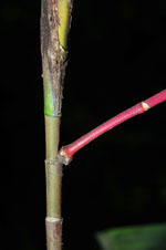
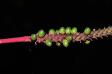
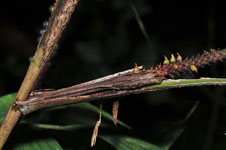
| Field notes | Cespitose understory palm. Stem 150 cm high, 0.8 cm thick; internodes 2.5 cm long, brown, smooth. Leaves 8 per stem; sheath 13 cm long, closed; petiole 12 cm long, section round; rachis 31 cm long; lamina pinnate, 40 cm long, 24 cm wide, flat, glabrous; basal pinna 13 cm long, middle pinnae 18 cm long; apical pinnae 17 cm long. Infructescence infrafoliar; peduncular bract 9 cm long, 0.5 cm wide; peduncle 6 cm long, 0.7 cm wide; rachis 12 cm long, 1.2 cm wide. Fruits green, 3 cm long, 2 cm wide. Silica gel sample taken. Transect: HB 412, subunit no. 1, outside transect |
| |
| Display all 69 georeferenced records of Geonoma Geonoma stricta var. trailii |
| New Search Modify Search |