AAU Herbarium Database |
| New Search Modify Search |
| Collector | Balslev, H. |
| Number | 8358 |
| Collected with | D. Pedersen, M.V. Sørensen, A.K. Brunbjerg & C. Grández |
| Country | Peru |
| Subpart | Madre de Dios |
| County | |
| Locality | Tambopata province. 14.8 km NE of Puerto Maldonado, 1.5 km SW of Estacion Cientifica Ita. North bank of Río Madre de Dios. Primary forest on floodplain |
| Coordinates | 12° 32' 17.04'' S 69° 3' 22.5'' W |
| Minimum elevation (m) | 183 |
| Maximum elevation (m) | 183 |
| Start date | 2011/03/23 |
| End date | 2011/03/23 |
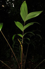
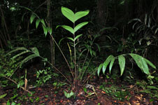
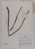
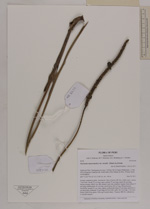
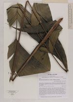
| Family | Arecaceae |
| Identification | Geonoma macrostachys var. acaulis (Mart.)A.J.Hend. |
| Determined by | Henrik Balslev |
| Identification qualifier | |
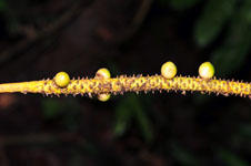
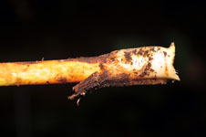
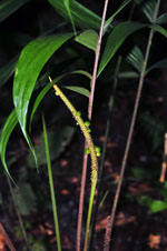
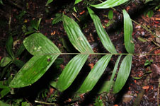
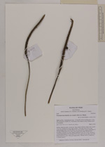
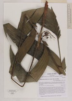
| Field notes | Solitary understory palm. Acaulecent. Base of stem with few visible roots. Leaves 7 per stem; sheath 33 cm long, open; petiole 77 cm long; rachis 56 cm long; lamina pinnate, 68x51 cm, flat; pinnae 4 per side, insertion regular; basal pinna 35 cm long, middle pinna 43 cm long, apical pinna 28 cm long. Infructescence interfoliar; prophyll 2 cm wide, papery; peduncular bract 23 cm long, inserted 0.1 cm from base; peduncle 70 cm long, 0.8 cm wide; spike 18.5 cm long; 3 cm wide. Fruits 0.8x0.8 cm, green. Silica gel sample taken. Transect: HB 411, subunit no. 4, outside transect |
| |
| Display all 211 georeferenced records of Geonoma Geonoma macrostachys var. acaulis |
| New Search Modify Search |