AAU Herbarium Database |
| New Search Modify Search |
| Collector | Balslev, H. |
| Number | 8357 |
| Collected with | D. Pedersen, M.V. Sørensen, A.K. Brunbjerg & C. Grández |
| Country | Peru |
| Subpart | Madre de Dios |
| County | |
| Locality | Tambopata province. 24.7 km NE of Puerto Maldonado, 8.5 km NE of Estacion Cientifica Ita. East bank of Río Madre de Dios. Tres Cargantes. Primary forest on floodplain |
| Coordinates | 12° 29' 40'' S 68° 58' 32'' W |
| Minimum elevation (m) | 191 |
| Maximum elevation (m) | 191 |
| Start date | 2011/03/22 |
| End date | 2011/03/22 |
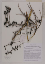
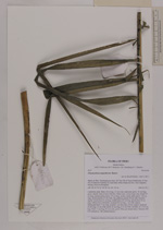
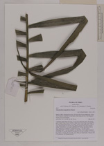
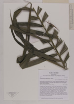
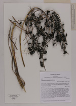
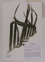
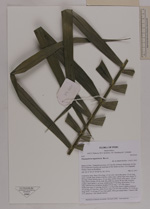
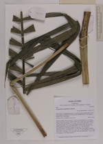
| Family | Arecaceae |
| Identification | Chamaedorea angustisecta Burret |
| Determined by | Henrik Balslev |
| Identification qualifier | |
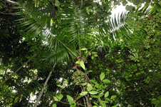
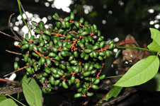
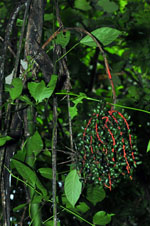
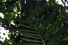
| Field notes | Understory palm. Stem 3.8 m long, 3.5 cm wide; internodes aprox. 10 cm long, green, smooth. Base of stem with few visible roots. Leaves 8 per stem; sheath 35 cm long, closed; petiole aprox. 55 cm long, section round; rachis aprox. 142 cm long; lamina pinnate, 87 cm wide, flat, glabrous; pinnae 46 per side, insertion regular; basal pinna 41 cm long, middle pinna 47 cm long, apical pinna 33 cm long. Inflorescence infrafoliar; prophyll 49 cm long, 1 cm wide, papery. Peduncular bract 17 cm long, inserted 1 cm from base, brown, papery; peduncle 29 cm long, 0.5 cm wide; rachis 24 cm long, 0.35 cm wide; rachillae 16, 15-20 cm long. Fruit 1.5 cm long, 0.7 cm wide, green. Silica gel sample taken. Transect: HB 410, subunit no. 100, outside transect |
| |
 Other records of Chamaedorea angustisecta Other records of Chamaedorea angustisectaThe map displays only records from the Aarhus Herbarium Database. The records may not represent the full distribution of Chamaedorea angustisecta |
| New Search Modify Search |