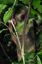
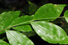
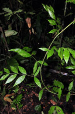
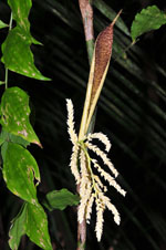
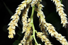
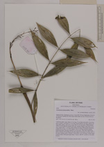
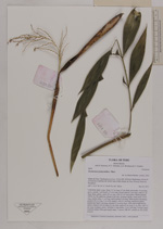
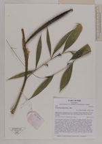
| Field notes | Understory palm. Liana. Stem 3.27 m long, 0.7 cm thick; internodes 14 cm long, green, smooth. Leaf sheath 15.5 cm long, closed; petiole 5 cm long, with 0.2 cm long, black, spines; rachis 29 cm long, with 0,2 cm long spines; lamina pinnate, 18x36 cm, flat, glabrous; pinnae 6 per side, insertion regular; basal pinna 10 cm long, middle pinna 11 cm long, apical pinna 9 cm long. Inflorescence interfoliar; prophyll 29 cm long, 2 cm wide, papery, with 0.2 cm long, red/brown spines; peduncular bract 5 cm long, inserted 23 cm from base, with yellow/light brown spines; peduncle 38 cm long, 0.5 cm wide; rachis 21 cm long, 2 cm wide, with 2.5 cm long, bordeaux spines; rachillae 13 per rachis, 3.5-6.5 cm long. Flowers cream colored, sessile. Silica gel sample taken. Transect: HB 407, subunit no. 90, inside transect |