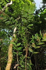
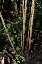
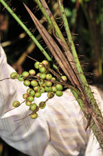
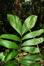
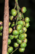
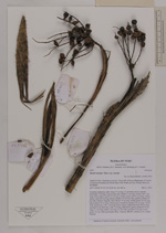
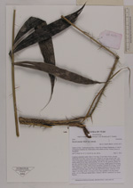
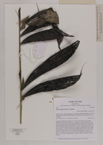
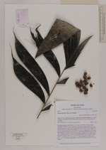
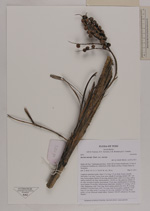
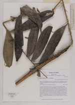
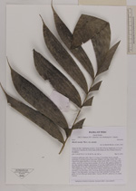
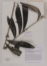
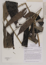
| Field notes | Cespitose understory palm. Stem 2.7 m long, 2.5 cm thick, brown, smooth; internodes 5 cm long. Leaves 8 per stem; sheath 21 cm long, closed, with 1 cm long, brown spines; petiole 42 cm long, section round, with 2.5 cm long, yellow spines; rachis 82 cm long; lamina pinnate, 101x50 cm, flat, glabrous; pinnae 10 per side, insertion irregular, basal pinnae 19 cm long, middle pinnae 24 cm long, apical pinnae 29 cm long. Inflorescence interfoliar; prophyll 22 cm long, 1.8 cm wide, herbaceous, with 1 mm long, brown spines; peduncular bract 28 cm long, inserted 9.5 cm from base, with 1 cm long, dark brown spines; peduncle 19 cm long, 0.7 cm wide; rachis 3 cm long, 0.5 cm wide; rachillae 9 cm long. Fruits green, 1x1 cm. Silica gel sample taken. Transect: HB 407, subunit no. 63, inside transect |