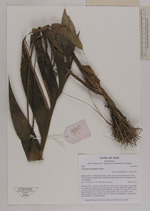
AAU Herbarium Database |
| New Search Modify Search |
| Collector | Balslev, H. |
| Number | 8350 |
| Collected with | D. Pedersen, M.V. Sørensen, A.K. Brunbjerg & C. Grández |
| Country | Peru |
| Subpart | Madre de Dios |
| County | |
| Locality | Tambopata province. 16 km NE of Puerto Maldonado, 0.5 km NE of Estacion Cientifica Ita. North bank of Río Madre de Dios. Primary forest on floodplain |
| Coordinates | 12° 32' 4.26'' S 69° 2' 53.28'' W |
| Minimum elevation (m) | 193 |
| Maximum elevation (m) | 193 |
| Start date | 2011/03/20 |
| End date | 2011/03/20 |
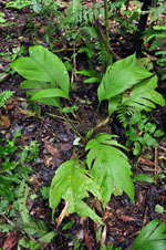
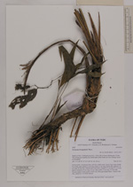
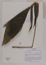
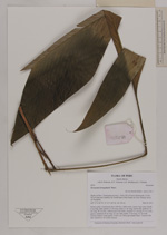
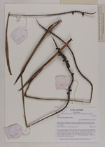
| Family | Arecaceae |
| Identification | Geonoma brongniartii Mart. |
| Determined by | Henrik Balslev |
| Identification qualifier | |
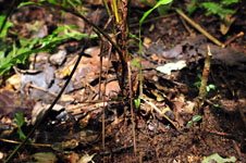
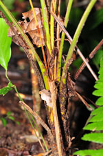
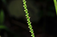
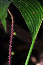
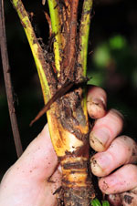
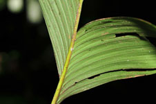
| Field notes | Solitary palm. Acaulecent; base with few visible roots. Leaves 6 per stem; sheath 4 cm long, open; petiole 33 cm long; rachis 31 cm long; lamina flat, glabrous, 41 cm long, 20 cm wide. Inflorescence interfoliar; prophyll 12 cm long, 0.5 cm wide, papery; peduncle 25 cm long, 0.3 cm wide; rachis 15 cm long, 0.3 cm wide. Flowers sunken. Fruits green, 0.5x0.5 cm. Silica gel sample taken. Transect: HB 406, subunit no. 24, inside transect |
| |
| Display all 110 georeferenced records of Geonoma Geonoma brongniartii |
| New Search Modify Search |